Dardilly
Dardilly (Dardelyé) is a commune in the Metropolis of Lyon in Auvergne-Rhône-Alpes region in eastern France.
Its inhabitants are called Dardillois in French.
An undulating town to in the western lyonnais, Dardilly is crossed to the east by the A6 autoroute and the RN6 and to the west by the RN7. Marked by a pleasanter, greener and more rural lifestyle, Dardilly's center is only 20 minutes by car from the Lyons peninsula. (By TCL bus: lines 3, 89, and by train, from the Saint-Paul suburb, - Lozanne).
Dardilly, with its 13.99 km2, includes three valleys oriented north south: the valley of ruisseau de la Beffe to the west, the valley of the ruisseau des Planches and the valley of the ruisseau de Serres to the east. Its altitude varies between 260 and 390 metres, allowing exceptional views over the Monts d'Or, the Monts du Lyonnais and even on clear days the Alps, from Vercors to Mont Blanc.
The Town also possesses 1.73 km2 of leafy forests of ones and 6.46 km2 of farmland. Many paths for walkers, horseriders and mountain-bikers criss-cross these spaces:
* chemin du Bois de Serres (walkers' information centre)
* sentier de la Beffe
* chemin de la Thuillière
* sentier de Chantemerle
* chemin du Pont
Map - Dardilly
Map
Country - France
 |
 |
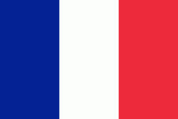
| Flag of France | |
Inhabited since the Palaeolithic era, the territory of Metropolitan France was settled by Celtic tribes known as Gauls during the Iron Age. Rome annexed the area in 51 BC, leading to a distinct Gallo-Roman culture that laid the foundation of the French language. The Germanic Franks formed the Kingdom of Francia, which became the heartland of the Carolingian Empire. The Treaty of Verdun of 843 partitioned the empire, with West Francia becoming the Kingdom of France in 987. In the High Middle Ages, France was a powerful but highly decentralised feudal kingdom. Philip II successfully strengthened royal power and defeated his rivals to double the size of the crown lands; by the end of his reign, France had emerged as the most powerful state in Europe. From the mid-14th to the mid-15th century, France was plunged into a series of dynastic conflicts involving England, collectively known as the Hundred Years' War, and a distinct French identity emerged as a result. The French Renaissance saw art and culture flourish, conflict with the House of Habsburg, and the establishment of a global colonial empire, which by the 20th century would become the second-largest in the world. The second half of the 16th century was dominated by religious civil wars between Catholics and Huguenots that severely weakened the country. France again emerged as Europe's dominant power in the 17th century under Louis XIV following the Thirty Years' War. Inadequate economic policies, inequitable taxes and frequent wars (notably a defeat in the Seven Years' War and costly involvement in the American War of Independence) left the kingdom in a precarious economic situation by the end of the 18th century. This precipitated the French Revolution of 1789, which overthrew the Ancien Régime and produced the Declaration of the Rights of Man, which expresses the nation's ideals to this day.
Currency / Language
| ISO | Currency | Symbol | Significant figures |
|---|---|---|---|
| EUR | Euro | € | 2 |
| ISO | Language |
|---|---|
| EU | Basque language |
| BR | Breton language |
| CA | Catalan language |
| CO | Corsican language |
| FR | French language |
| OC | Occitan language |


